Hello, Green Space Friends!
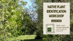
Come celebrate the summer solstice with us at our Native Plant Identification Workshop at St. Paul’s Episcopal Church green space on Saturday, June 20th at 10 a.m.
Amanda Ruffini from Lake St. Clair CISMA will help us learn about the ecosystems that once existed there, identify the plants growing there now and begin a biological assessment that will form the foundation of our long-term management plan. We’ll do some learning inside the church, then head out for field work and mapping. As always, we will have coffee and snacks for everyone and look forward to seeing you!
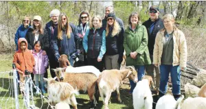
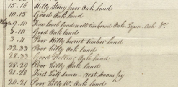
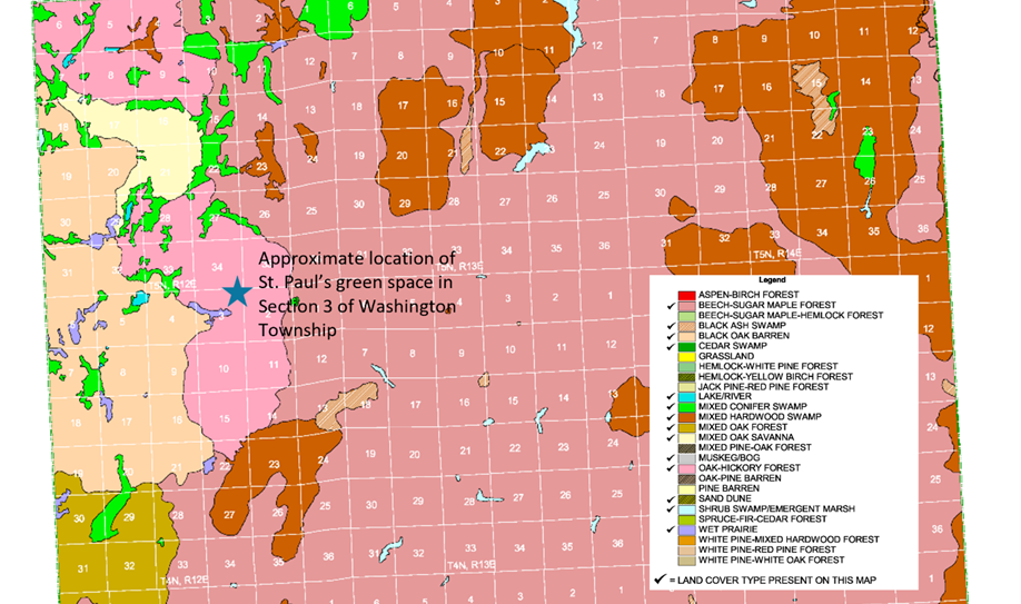
When you visit the green space now, you see a broad expanse of mowed grass and dense woods where we (and the goats!) removed invasive woody plants and herbaceous weeds at our earlier workdays. But what was this land like before, when the land was lived on and actively managed by the Anishinaabe people? Based on the notes of surveyors sent out by the General Land Office in 1818, we know that St. Paul’s green space was part of a larger oak-hickory forest. The Michigan Natural Features Inventory (MNFI) scientists analyzed the surveyor’s notes with other data to create a pre-settlement map of Michigan.
The excerpt below shows notes written by the surveyor Joseph Wampler in 1818 describing the land and vegetation in what is now Washington Township. The observation of “burnt timber land” is indicative of land management with fire by the Anishinaabe who lived in the area.
Below is an excerpt from MNFI’s pre-settlement map of Macomb County. The blue star shows the location of the St. Paul’s green space within the pink area identified as oak-hickory forest. Visit MNFI to see the entire Macomb County map.
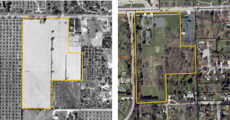
Aerial photographs of the land at St. Paul’s Episcopal are available starting in 1949, after the land had been cleared for agriculture and was surrounded by orchards. The church was built in the 1960s and the second-growth woods we see today began to fill in around 1980.
The change in land cover over 75 years is seen in the aerial photographs below. The photo on the left was taken in 1949 by DTE; photo on the right in 2024 by Macomb County. The yellow line has been added to show the current boundary of the St. Paul’s Episcopal property.
It has been quite a journey for the green space at St. Paul’s. Now that we’ve had a taste of its history, we hope you are as excited as we are to build a vision for its future. See you Saturday!
All the best,
Donna Folland
Chair, Green Space Romeo